According to many the most beautiful landscape in the US.
11 travellers have this on their Bucket List
0 been here
Bryce Canyon is considered by many to be the most beautiful national park in the United States. It is more of a fairytale landscape than a nature reserve. Mother Nature has gone wild at Bryce with the creation of a wonderful landscape. This jewel can easily be explored on foot.
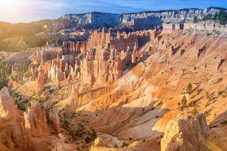
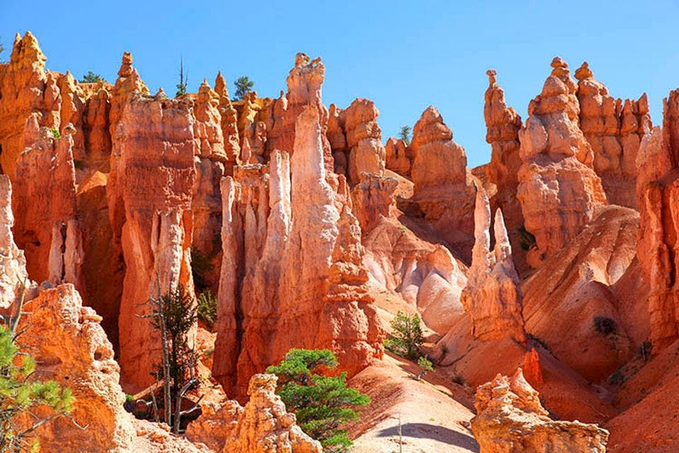
Think of thousands of pillars of red and orange stone towering above bright green pine trees. Some neatly in a row, others criss-cross together. And (often) as an encore: a bright blue sky. This bizarre landscape was created for postcards and posters. And photos of course.
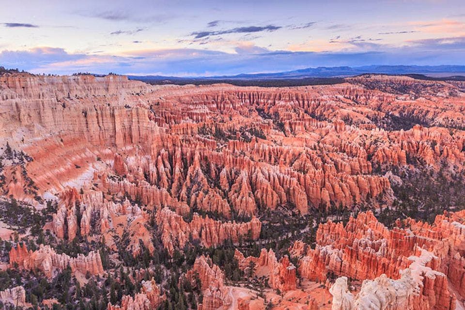
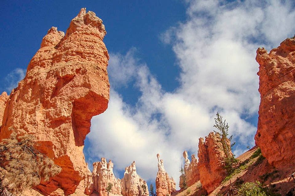
Bryce Canyon is wondrous. It’s a stack of rocks, and (despite its name) isn’t really a canyon. It looks more like a row of amphitheatres with thousands of bizarre rock formations. Yes, it’s really unique in the world.
Not many people know that Bryce was once upon a time an inland sea. When you see Bryce Canyon for the first time, you can barely believe your eyes. The predominate colours are bright red and orange, and remarkably shaped rocks dominate the landscape. It makes you feel very small. Especially if you know the history of this area.
I visited Bryce Canyon several times. The first time was in spring, and later again in the winter with snow. These are my best tips for all the sights and hikes before your visit. With all the must-see attractions. Take your time for this place. It's more than worth it.
Fairyland Point in Fairyland Canyon
A view of Fairyland Point in Fairyland Canyon.
Fairyland Canyon is a true fairyland. You can see why the Paiute Indians thought the hoodoos were in fact petrified people. They are lined up next to each other, sometimes strikingly close to the viewpoint. And all this because of the unique interplay of wind and rain for centuries. Fairyland Canyon is located in the northern part of the park, on the main route.
Bryce Point
The lovely Bryce Point in soft light.
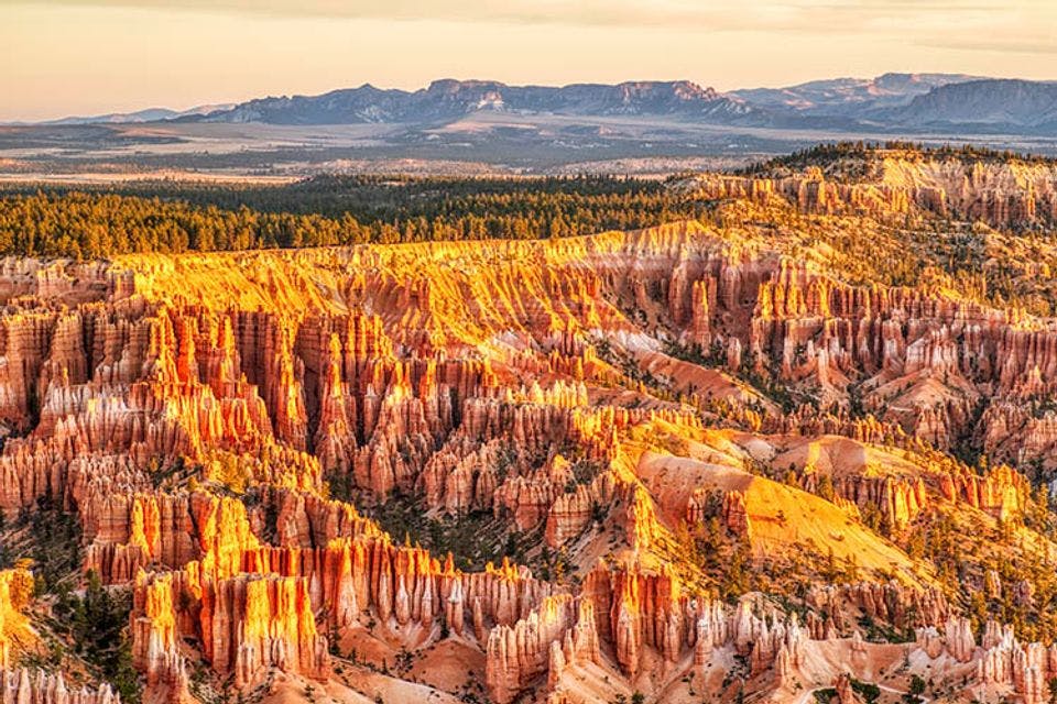
Bryce Point is arguably the most popular with visitors. This is a great viewpoint to experience the bizarre landscape in all its grandeur. You can see the amphitheater, as it is often called, in all its glory. With countless shades of color that change with the weather and striking straight rows of trees that grow between the rocks. So this is a good place to visit in the morning and afternoon, for example. Then you can see the differences clearly.
Inspiration Point
The colours of Inspiration Point.
Inspiration Point shows well the different colours that the rocks in Bryce Canyon take on. Especially in the early morning or late afternoon. The rocks are arranged one behind the other in three layers, all of which differ in color. The lowest are almost pink, while the higher rocks are almost white.
Sunrise Point
Sunrise at Sunrise Point.
This vantage point offers one of the best views in the park. From Sunrise Point you can even see over the boundary of the park, the Pink Cliffs are visible in the background. And you can also see how pine trees cling to the rocks and sand. Sometimes their roots are exposed due to erosion. It indicates how difficult it is for trees to grow on this soil. And as the name implies, the sunrise is definitely worth it.
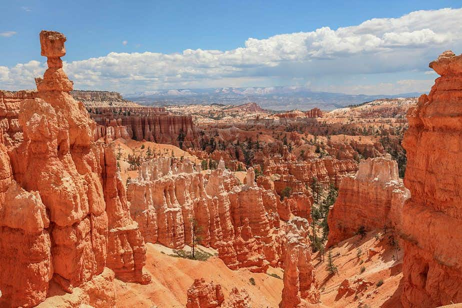
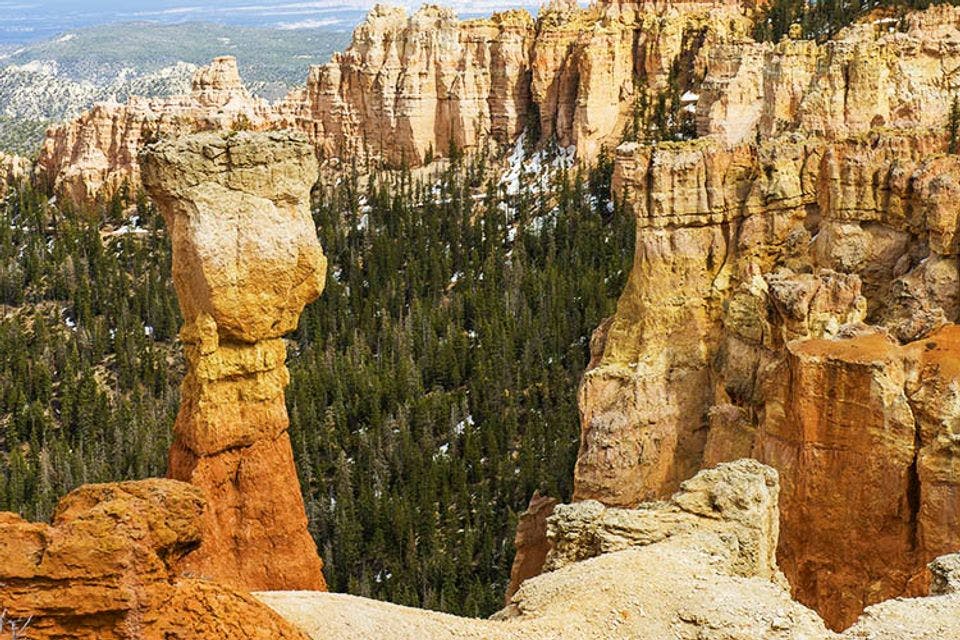
Sunset Point
Sunset Point in Bryce Canyon.
The name of Sunset Point says it all, this is a good place to watch the sunset. But this place is not only worth seeing when the sun goes down. The different colours of the rocks are clearly visible. This site is also home to one of the most famous rocks: Thor's hammer. This lonely rock stands out far above the others. And yes, with a little imagination it looks like a giant hammer. Along with Sunrise Point and Bryce Point, you look out over Bryce’s Amphitheater, an immense backdrop of hoodoos and trees.
Paria View
Enjoying Paria View.
Oddly enough, this viewpoint (and not Sunset Point) is ranked as the best place to watch the sun go down. The reason is simple, this is the only place where the last rays of the sun reach the hoodoos. The rest of the park is then in the shade for a long time.
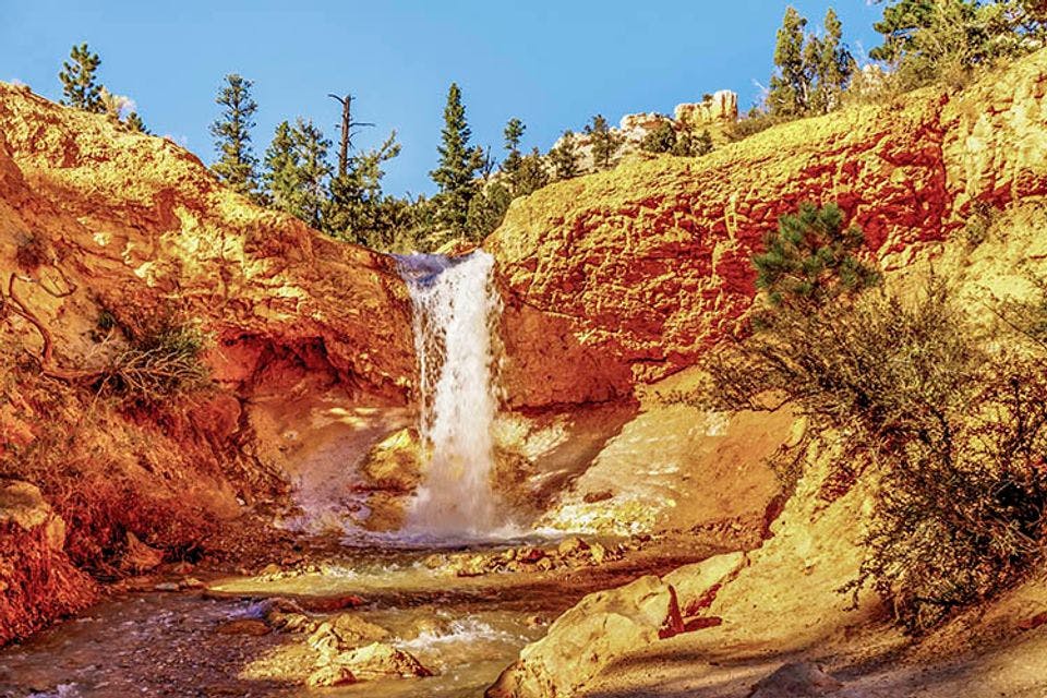
Mossy Cave
The waterfall of Mossy Cave.
One of the least known viewpoints of Bryce Canyon is Mossy Cave. Which is remarkable. Because you can hike between the many strange rocks, without having to descend a steep path. This is different than the rest of the park.
Mossy Cave is located in the north of the park on Highway 12 and is easily accessible. The name comes from a cave with moss, where a small waterfall can be seen roughly from October to May. This one is called Ditch Falls. You can easily take a walk and see everything up close.
Swamp Canyon
The name Swamp Canyon is a bit misleading.
Swamp Canyon is a remarkable part of the park. It is extremely wet compared to the rest of the area. Two creeks run in this narrow gorge that even provide a place for salamanders and countless songbirds. The plant world is also different from the rest of the park. It's ideal for an exploration.
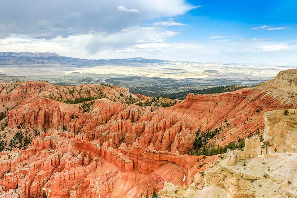
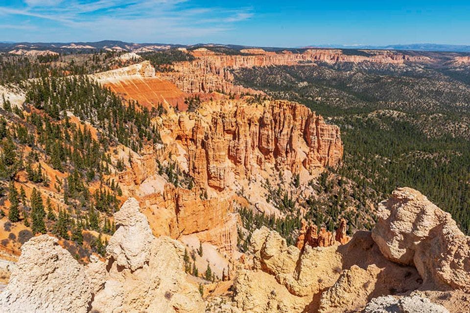
Farview Point
Farview Point is stunning.
This viewpoint particularly shows the surrounding area of Bryce. In other words, you can clearly see how the landscape slowly changes into forest. Sometimes it is not easy to understand why forests grow in some places and a row of pillars stand a little further. You can see for miles, in clear weather.
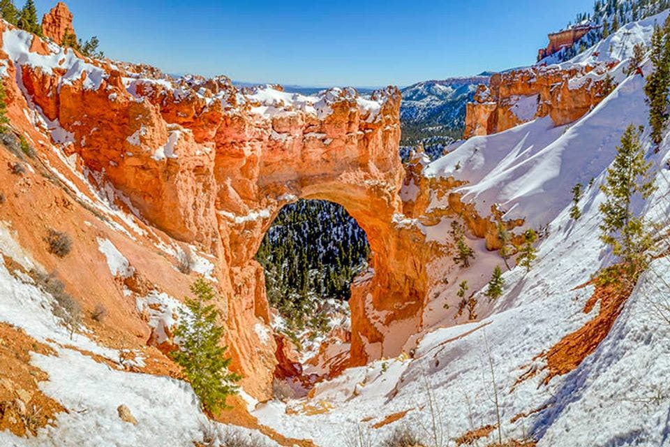
Natural Bridge
Snow at the Natural Bridge.
The Natural Bridge is one of the seven natural arches in Bryce Canyon, and the most impressive. Despite its name, it is not a bridge, but the result of extreme erosion of an immense rock. The water is guided through the gorge, as it were, so that erosion continues in the meantime. Someday this arch will collapse.
Aqua Canyon
Extreme erosion in Aqua Canyon.
Also in Aqua Canyon you can see the effect of erosion in optima forma. The landscape full of hoodoos has almost disappeared, except for two persistent ones. The Hunter and The Rabbit are still proud in the otherwise almost deserted landscape. The rocks were once given these names because they resembled hunters and a rabbit, but the wind and rain mean that they are no longer visible. As a result, many rock formations nowadays no longer get a name.
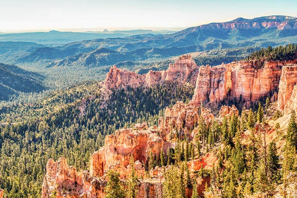
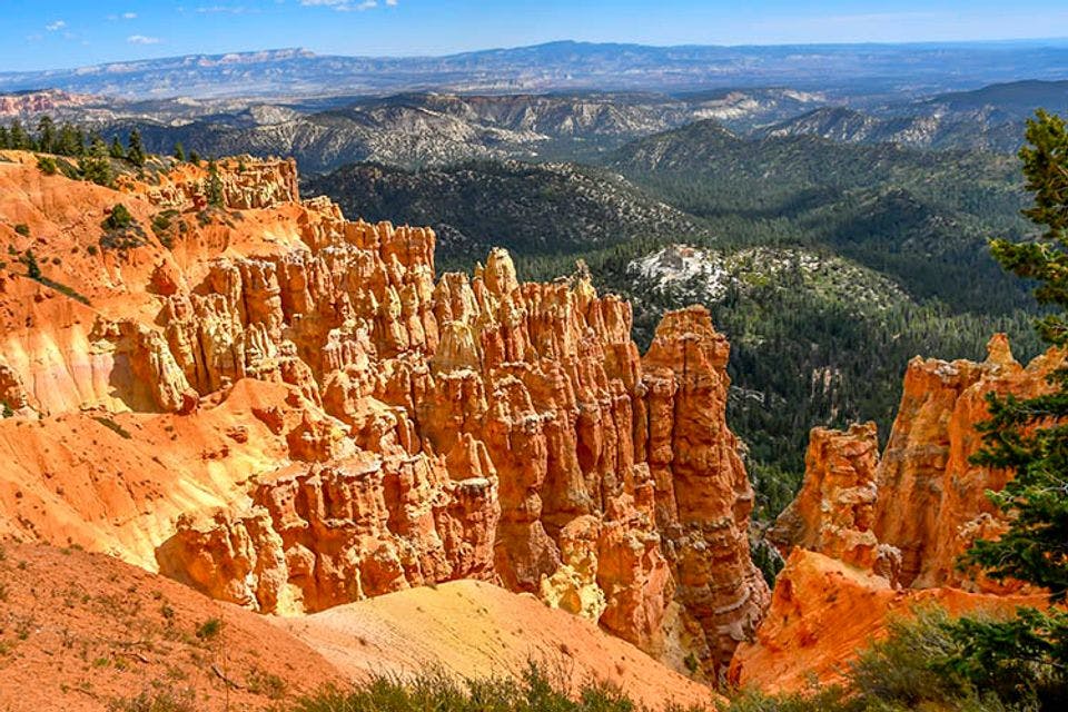
Rainbow Point en Yovimba Point
Discovering Rainbow Point.
Both Rainbow Point and Yovimba Point are popular viewing points. They are located in the very south of the park and are often skipped by the tourists. While you can clearly see how Bryce Canyon arises from the surrounding rock plateau. And you can also see how the edge of the plateau has now become hoodoos, in all kinds of shades. You can also see Pink Cliffs and Gray Cliffs that are just outside the park.
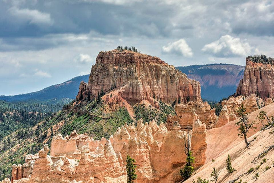
Ponderosa Canyon
Ponderosa Canyon at it's best.
In Ponderosa Canyon you can clearly see that nature tries to use every piece of land. Where possible, trees grow on small pieces of rock. But in many places the rocks are too steep for any life, which makes for a dramatic landscape. This canyon is located in the southern part of Bryce Canyon.
Hiking in Bryce Canyon: Rim Trail (17,7 km)
To experience this nature reserve optimally, you have to go hiking. There are several walking routes to choose. In fact, there is plenty of choice.
The Rim Trail is the most popular hike. This takes you past most viewpoints. With numerous vantage points along the way to stop. But don't take too many photos, because you will still get to see a lot.
Wandelen in Bryce Canyon.
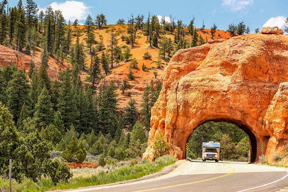
Bryce Canyon by car
Visitors can reach almost the entire park by car, and then walk to a viewpoint. The only road (30 km long) is on top of the mountain pass at about 2,400 to 2,800 meters. Whoever comes by car will see the colours change, especially if the weather conditions also change.
People have tried to inhabit this region. First Native Americans, to whom the area is sacred. Then white people. These days the most common people are tourists.
Driving in Bryce Canyon.
Over the last few decades Bryce Canyon has become one of the most popular parks in the US. It’s remarkable that most tourists simply drive around and visit the lookouts, and that not many people explore the area on foot. Though there are many opportunities to really get to see it up close, instead of the American way from inside a vehicle.
History of Bryce Canyon
The origins of this region are very special. Geologists believe that this part of the US was a huge inland sea more than 100 million years ago, and several rivers flowed into it. Water had free range here, so sand, sediment and chalk found their way to the seabed. This area can now be found at 2.400 to 2.800 metre altitude.
Hoodoos on the Rim Trail in Bryce Canyon.
The rock formations were once upon a time the bottom of the ocean. When the tectonic plates started moving, it was pushed upward. Wind, rain, snow and ice took millions of years to sculpt the layers of limestone, sandstone and chalk so that the landscape is almost surreal now.
The role of water
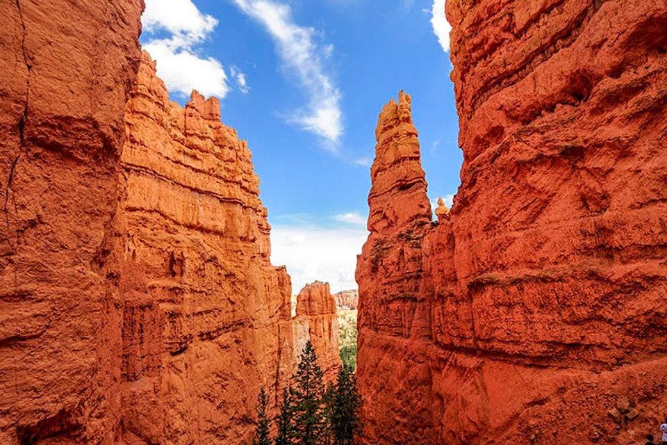
Water in particular plays an important role in Bryce Canyon. Every day the water from melted ice seeps into the porous surface. During the night, the water freezes and expands, which causes rocks to crack and parts of them to fall. The result of this process is what you see.
A close view of Bryce Canyon.
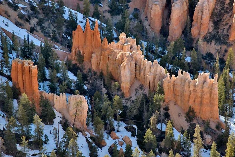
The pine trees of Bryce Canyon
Thousands of pillars of red and orange rock rise up above the bright green pine trees. Some are in neat rows, others in chaotic patterns. And often there’s a blue sky to complete the picture. This bizarre landscape was made for posters and postcards, and photos, of course.
Bryce Canyon has an American infrastructure – you can drive around the entire park and simply walk the last few hundred metres to a lookout. The only road (30 km long) is on a mountain pass at about 2.400 to 2.800 metre. When you drive in you can see the colours in the landscape change, especially when the weather conditions also change.
Wildlife in Bryce Canyon
The area is also home to around 59 mammals, such as the mule deer, moose, black bear, puma, coyote and several kinds of marmots and ground squirrels, including the rare Utah prairie dog. And ravens, who make their presence loud and clear. Sometimes you can see eagles circle above the landscape.
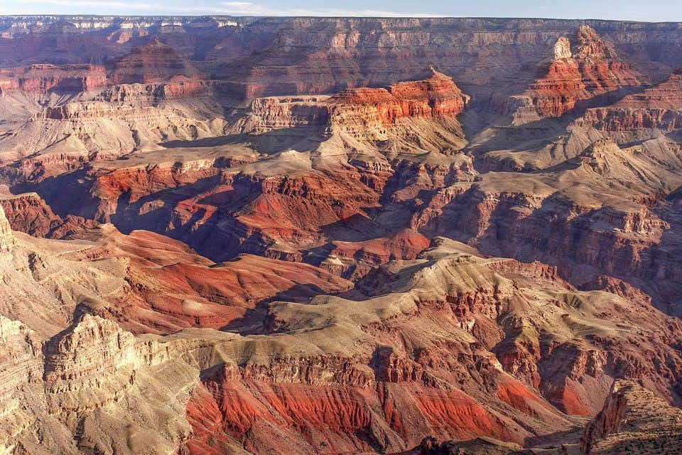
Connected with Grand Canyon en Zion
Bryce Canyon belongs to the same huge mountain plateau as the Grand Canyon and Zion. It’s known as the Grand Staircase. It’s interesting that you can see the different stages of erosion the in the different parks. Bryce is the youngest, while Zion is millions of years older, and the Grand Canyon is an example of what will happen when erosion continues to occur.
Bryce Canyon wordt meestal via een rondreis bezocht per auto of camper. Waarbij ook andere nationale parken in het westen van de VS worden aangedaan. En ja, dit park hoort op je Bucket List te staan…